
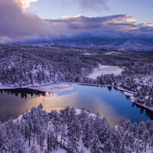
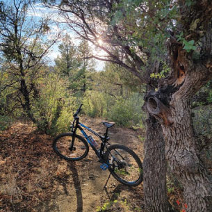
EXPLORE PRESCOTT TRAILS
Prescott has it all, including rugged hiking trails with rewarding Arizona vistas. Look no further to find a great hiking trail in the area—choose from these top picks!
The Prescott area has over 85 great hiking trails, mountain biking trails, or running trails ranging from 0.5 to 54.6 miles in length and from 5,016 to 7,687 feet above sea level. (Prescott also hosts countless equestrian trails). The majority of the hiking/biking trails are easy to moderate so even a novice can enjoy the scenic beauty Prescott has to offer. Below we’ve listed some of our favorite trips-all are just a few minutes from either the courthouse square or PV town center.
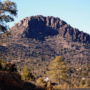
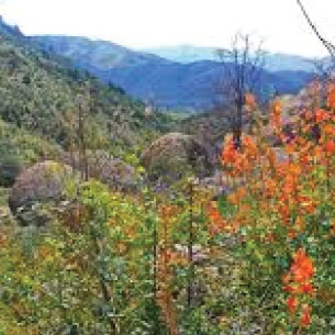
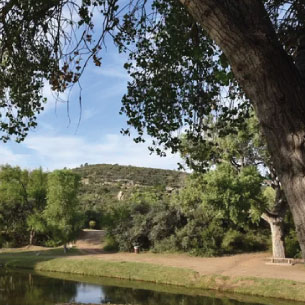
THUMB BUTTE TRAIL #33
DISTANCE: 2.5 MILES ELEVATION GAIN: 688 FEET ROUTE TYPE: LOOP
- Pets Allowed? Yes; dogs must be on a leash at all times
- Fees: $5 for day use (free on Wednesdays)
- Hiking Time: About 1 hour to complete the trek
- Website: www.fs.usda.gov
A rewarding hike with awe-inspiring views.
One of Prescott’s most iconic landmarks, Thumb Butte, is nestled within the Prescott National Forest. Not surprisingly, the trail that skirts along this local hiking spot is one of the most well-used and well-loved of all the trails within the national forest.
The trail is limited only to hiking. It is Prescott’s most popular hiking trail located just 3.56 miles from the Courthouse Square. The 1.75 mile loop is paved and rated moderate difficulty. The trail loop begins moderately steep and levels more gently as it passes through forested canyon. The views at the top of Prescott, the Bradshaw Mountains and Mingus Mountain are spectacular. On a clear day you can see the San Francisco Peaks north of Flagstaff, Arizona.
Directions: Head west on Gurley St. (a few miles) which will turn into Thumb Butte Rd. Continue northwest to the trailhead parking area.
PRESCOTT HOMES OVERLOOKING THUMB BUTTE
Love the view? Take it with you to your home. Explore Prescott-area homes with views of Thumb Butte below.
PIONEER PARK TRAIL
DISTANCE: 4.9 MILES ELEVATION GAIN: 324 FEET ROUTE TYPE: LOOP
Pioneer Trail is a 4.9 mile loop trail located that features beautiful wild flowers. The trail is rated as moderate and is primarily used for hiking and mountain biking. NOTE: there is no shade
Picnic facilities may be found on Willow Creek Road at Willow Springs Lake Park or Heritage Park by returning down Commerce Drive and turning left. The parks are just up the road.
Directions: From the Courthouse go North on Montezuma appx 1.1miles continue onto Whipple St appx 0.7 miles to turn right onto Willow Creek Rd then appx 4.0 mi to left onto Commerce Dr. Trailhead is appx 0.8 miles on your left.
GROOM CREEK LOOP #384 (WOLF CREEK)
DISTANCE: 5.4 MILES ELEVATION GAIN: 810 FEET ROUTE TYPE: LOOP
Wolf Creek Loop Trail #384 features a waterfall and is rated as moderate. Hiking, biking & motorized vehicles less than 40″ wide are permitted. Maverick Mountain & Mt. Trittle provide a gorgeous backdrop as the trail winds through lush vegetation along the upper basin of the Hassayampa River. It takes under 4 hours to hike this moderate to easy loop.
Directions:From downtown Prescott head south on Mount Vernon approximately 6 miles to Groom Creek. At the dirt road turn right to Wolf Creek. The trail will cross the road within 0.4 miles.
GROOM CREEK HANDICAP TRAIL
This is an easy and pleasant, scenic hike. Picnic tables are available.
Directions: Follow the directions to Goldwater Lake and continue on Senator Highway through Groom Creek to the old schoolhouse. Park in the parking area and follow the asphalt trail into the forest.
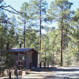
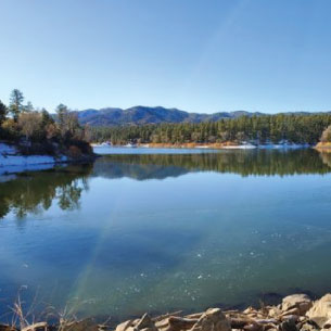
GOLDWATER LAKE AND TRAIL #396
DISTANCE: 8.1 MILES ELEVATION GAIN: 1,233 FEET ROUTE TYPE: OUT & BACK
Goldwater Lakes Trail #396 is a 8.1 mile lightly trafficked out and back trail that features a lake and is good for all skill levels. The trail offers a number of activity options and is accessible year-round. Dogs are also able to use this trail but must be kept on leash. There are benches to enjoy the great view of the lake shore. The trail system is also well-marked and maintained.
The park at Goldwater has a picnic area, fishing, canoeing and facilities. Enjoy hiking around the lake to the far side of the dam. Return via the same trail
DIRECTIONS: Located at 2900 S Goldwater Lake Rd, go south on Mount Vernon Street, which becomes Senator Highway, about 3.3 miles to the entrance of the lake. Turn right and park in the designated parking spots only. There is a small parking fee of $3 per car and an annual pass is available.
- 15-acre lake with fishing docks
- Boat launch ramp~no gasoline motors~electric only
- Outstanding for canoeing/kayaking
- Restrooms
- 3 Large Ramadas
- Ceremony Pad
- Playground
- Picnic tables
- Sand volleyball court
- Hiking trails
- Horseshoe pits
- Handicapped access picnic sites
- No Swimming
- Canoe and kayak rentals available. For detailed information, prices, and hours of operation, refer to Prescott Outdoors
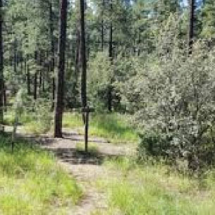
MINT WASH & GRANITE BASIN TRAILS
DISTANCE: 3.1 MILES ELEVATION GAIN:357 FEET ROUTE TYPE:LOOP
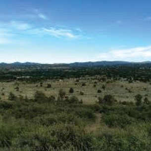
Mint Wash and Granite Basin Lake Loop is a 3.1 mile lightly trafficked loop trail. It features a lake and is good for all skill levels. The trail offers a number of activity options and is accessible year-round. Mint Wash passes through a mixed forest of ponderosa pine and alligator juniper as it as it travels toward Granite Basin Lake. The trail crosses a creek several times. Although the creek is usually dry, its banks are lined with dense vegetation that is nourished by occasional flows. This short trail provides access to other Granite Basin trails.
Dogs are also able to use this trail but must be kept on leash.
Directions: From Whiskey row head north on Montezuma then to Willis then to Whipple to Iron Springs (this is all the same road- it changes names). Continue on Iron Springs about 4 miles to the Granite Basin turnoff.
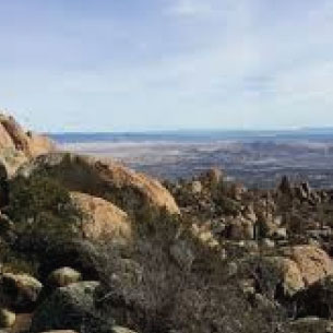
WILLIAMSON VALLEY TRAILHEAD-GRANITE BASIN LAKE
DISTANCE:7.6 MILES ELEVATION GAIN:518 FEET ROUTE TYPE:OUT & BACK
This is a 7.6 mile moderate rated and moderate traffic that features beautiful wildflowers. The trail is primarily used for hiking, walking, nature trips, and bird watching and is accessible year-round.
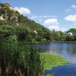
GRANITE BASIN LAKE
To the top of granite mountain is an 8 mile out and back hike, or you can just go as far as like and return. The first part is a fairly level the trek to the top. Picnic facilities are at the beginning of the trail.
Directions: From Whiskey row head north on Montezuma then to Willis then to Whipple to Iron Springs (this is all the same road- it changes names). Continue on Iron Springs about 4 miles to the Granite Basin turnoff.
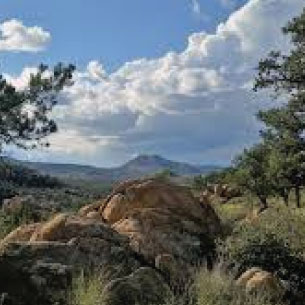
LITTLE GRANITE MOUNTAIN #37
DISTANCE: 6.2 MILES ELEVATION GAIN: 1,811 FEET ROUTE TYPE: LOOP
This is a moderate hike that takes about 1.5 hours. Hiking, horseback riding and non-motorized bicycling is permitted on this trail that offers striking panoramic views of Skull Valley, Sugarloaf Mountain and the western-end of the Sierra Prietas. For a loop hike, drop your vehicle at Granite Basin Lake (great canoeing). Take trail 37 from Iron Springs trailhead to the Clark Spring Trail turnoff, which leads to Granite Basin Lake.
Directions: Head north from downtown Prescott on Montezuma which will turn into Whipple Street to the Miller Valley, Willow Creek and Iron Springs road intersection. Continue straight on Iron Springs about 6.2 miles. The trailhead is 3.2 miles west of the turnoff to Granite Basin Lake.This is moderate hike and takes about 90 minutes. This trail offers striking panoramic views of Skull Valley, Sugarloaf Mountain and the western end of the Sierra Prietas
For a loop hike drop your vehicle at the Granite Basin Lake (which has great canoeing). Then take trail #37 from the Iron Springs Trailhead to Clark Spring Trail turnoff, this leads to the Granite Basin Lake.
LYNX CREEK RECREATION AREA
LAKE AND TRAILS
This area is located east and slightly north of the Courthouse square it is situated in the Prescott National Forest in and around Lynx Lake/Lynx Creek and boasts many great trails and scenic areas
NOTE: Due to the sensitive nature areas and unimproved access many of these trails are occasionally closed. Specifically; John’s Tank Trail #94, Salida Gulch Trail #95 and portions of the Lake Shore Trail #311. Please refer to USDA Forest Service site for current information https://www.fs.usda.gov/alerts/prescott/alerts-notices
Even if parts of the area are closed this is still a beautiful area and worth the trip. A map of the closure areas is usually posted at all trailheads accessing the area and well as on the Prescott National Forest website and the Bradshaw Ranger District office.
Directions: From Whiskey row go East on Gurley appx 1.2 miles bear right to E Hwy 69 for 3.2 miles turn right on Walker Road go appx 1.4 mile to Lynx Creek Road. Follow signs to the various trails.
SEE FOREST SERVICE MAP https://www.fs.usda.gov/Internet/FSE_DOCUMENTS/stelprd3809293.pdf
LYNX LAKE LOOP TRAIL
This is a 2.4 mile heavily trafficked loop trail located near around Lynx Lake and is good for all skill levels. The trail offers a number of activity options and is best used from March until September.
Dogs are also able to use this trail but must be kept on leash.
Part of the loop is frequently closed in December to early Summer due to Eagle nesting please refer to cautions mentioned above.
FOREST TRAIL #320
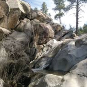
This an easy trail in a gorgeous section of the Prescott National Forest. Continue up the hill to reach Lynx Lake Road at the north end of the lake where you will find a picnic area, boat rentals and a general store. Take the side trail back at the Nature Center, then follow a small wash to Lynx Creek. Here you will see large boulders and a small flume. It is well worth the hike is any easy trail up the hill.
SALIDA GULCH TRAIL #95
This is a 4.5 mile moderately trafficked loop trail that features beautiful wildflowers and is rated as moderate difficult. The trail offers a number of activity options and is accessible year-round. Dogs and horses are also able to use this trail.
NOTE: The road is a bit rough but should be accessible in a passenger car. At the Forest Service Fence near the Creek (about a mile from Walker Road)-park in the open space. Cross the creek follow the trail on the south side of the Lynx Creek for about a mile to Salida Gulch
The road leading to the trailhead may be closed due to hazardous conditions. Please check this site before visiting: https://www.fs.usda.gov/recarea/prescott/recreation/rocks-minerals/recarea/?recid=67279&actid=59
LYNX CREEK RUIN TRAIL #301
This trail is an easy very pleasant hike, mostly flat with modest elevation to a high point with an elevated viewing platfor and is a nice finish to the Salida Gulch trail. While listed as .75 miles it is much shorter. There is an interpretive area overlooking a prehistoric of an ancient Indian culture.
As you enter the recreation area on Walker Rd you see signs to Lynx Creek Ruins turn left and go about 1/2 mile to a fee parking area.
CIRCLE TRAIL
he Prescott Circle Trail is a network of our best non-motorized trails that combine to make a 54 mile loop around Prescott . The PCT is jointly managed by the City of Prescott (25 miles) and Prescott National Forest (29 miles). The trail comes as close as three miles to downtown Prescott and is easily accessible with 15 trailheads along its length. A lap of the PCT has about 6000 feet of elevation gain and can be enjoyed as an adventurous one or two day trip or a multi-day trip over a period of days, weeks or months. Three of Prescott’s four seasons – spring, summer, and fall – offer superb conditions on the PCT.
Prescott Valley Trails
IRON KING TRAIL
DISTANCE: 4.0 MILES ELEVATION GAIN:524 FEET ROUTE TYPE:OUT & BACK
This out and back trail starting on the old mine rail trail in Prescott Valley and connects some 4 miles later to the Peavine trail in Prescott.
Iron King Trail (westward view) begins west of Glassford Hill Road, north of Spouse Drive. This trail traverses westward through Prescott Valley’s open grasslands toward the magnificent Point of Rocks. The trail features 3 wash crossings that utilize flatbed railcars – railcars used in the actual Prescott East Railroad operation.
Directions : From Whiskey Row turn East on Gurley St travel 7.4 miles East on Hwy 69 (Prescott Valley) turn left on Glassford Hill Rd for appx 2.3 miles to Santa Fe Loop Road. Trail head is on right (across Glassford ford Hill)
DOGS ARE ALSO ABLE TO USE THIS TRAIL BUT MUST BE KEPT ON LEASH.
FAIN PARK
This scenic 100-acre park was once was the home of gold prospectors on Lynx Creek. Fifty acres of the park comprises a passive recreation park with ramadas, a lake stocked with trout, hiking trails and limited gold panning.
Directions: From Whiskey Row turn East on Gurley St travel 7.8 miles East on Hwy 69 (Prescott Valley) turn right on N Prescott East Hwy appx 0.2 mile to E 2nd St turn left in another 0.2 mile turn right on N 5th St. Road to the entrance to the park.
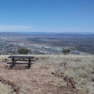
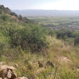
GLASSFORD SUMMIT TRAIL
DISTANCE:4.5 MILES ELEVATION GAIN:944 FEET ROUTE TYPE:OUT & BACK
This is a 4.5 mile moderately trafficked out and back trail that features beautiful wildflowers & is rated as moderate. The trail is located in Prescott Valley and is an extinct volcano that towers over East Prescott and Prescott Valley.
The trail is primarily used for hiking, walking, nature trips, and birding and is best used from April until September.
NOTE: The trail offers no shade, facilities and no water. It is a steep out and back, but the views are spectacular.
Directions: From Whiskey row turn right on W Gurley for 8.8 miles to N Prescott East Hwy (Prescott Valley). In 0.2 miles Turn left onto E Sunset Lane which turns into N Castle Dr. Trailhead is 0.3 miles on left at 6000 E Antelope Lane
STONERIDGE & LOOKOUT HILL
DISTANCE:3.2 MILES ELEVATION GAIN:364 FEET ROUTE TYPE:OUT & BACK AND/OR LOOP THROUGH SUBDIVISION.
StoneRidge Subdivision & Golf course offers appx 2.8 miles of paved and hilly trails through the subdivision, along the golf course and Lookout Hill. It features subdivision, prairie views and wildlife. Stoneridge offers several trailheads the one off Cloud Cliff offers direct access to the top of Lookout Hill with panoramic views of PV and Mingus Mountain. All trails are paved. The Cloud Cliff Pass Trailhead provides a 1.6 mile up one side and down the other of Lookout hill it’s appx 1.6 miles you can do an out and back or continue on through the trail and subdivison streets back to the trailhead. This ‘loop’ trail is about 1.5 miles and winds through the subdivision on paved trail and streets passing by the clubhouse under StoneRidge Drive, the golf course and then back to Cloud Cliff trailhead.
DIRECTIONS: From Whiskey row turn right on W Gurley for 7.6 miles to StoneRidge Drive (Prescott Valley). Follow for appx 2.7 miles to 1242 Cloud Cliff Pass.
Resources
This information presented is from the below sources, current information is maintained by them please consult the provided links for more information.:
- Arizona Leisure: https://www.arizona-leisure.com/prescott-hiking.html
- USDA: https://www.fs.usda.gov/activity/prescott/recreation/hiking
- City of Prescott:
- All Trails: https://www.alltrails.com/us/arizona/prescott
HAVE A FAVORITE TRAIL AND IT’S NOT LISTED? SEND US AN EMAIL AND WE’LL CHECK IT OUT.
PRESCOTT: MORE THAN A PLACE TO VISIT
Have you fallen in love with Prescott and want to live here as a permanent resident? We're always happy to introduce you to the communities and homes in the area. Contact us and let's talk about your plans.
Let's Stay in Touch
Contact Us today!
Joni R. Cahn | (928) 899-0646
